
This is Geographical Diversity of India Class 7 Chapter 1, from NCERT’s Exploring Society: India and Beyond (Part 1). The chapter runs 26 printed pages and opens with Rakesh Sharma’s reply from space, ‘Sāre jahān se achchha’. The official PDF is below, and after it you get a section-by-section walkthrough of what the chapter actually contains.
Use the jump links to go straight to any section, or scroll down to read the whole chapter explained.
Download the Official NCERT Chapter PDF
NCERT publishes Chapter 1 as file gees101.pdf in the Exploring Society: India and Beyond series. Use this official source to read the chapter exactly as printed: Download the Geographical Diversity of India Class 7 chapter PDF from ncert.nic.in. The file contains all 26 pages — the opening quote, the satellite views, the photographs and the nine closing questions.
Prefer to browse on screen? The NCERT textbook index lists this book and every other NCERT textbook in one place.
Chapter at a Glance: Sections, Figures and Exercises
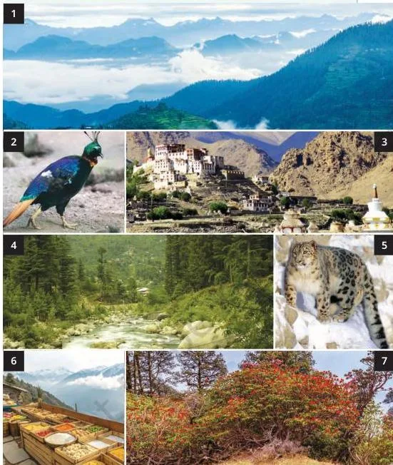
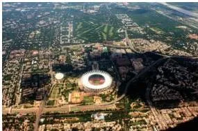
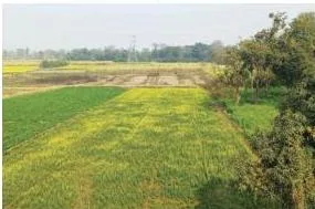
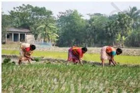
Use this table to see how much revision this chapter needs before opening the PDF.
| What the chapter holds | Count | Detail |
|---|---|---|
| Printed pages | 26 | Chapter opener on p.1, core content on pp.2-25, ‘Noodles’ page on p.26. |
| Chapter sections | 39 | Region headings plus LET’S EXPLORE, LET’S REMEMBER and DON’T MISS OUT boxes. |
| Captioned figures | 47 | Satellite views, landforms, wildlife and cultural photographs. |
| Discussion prompts | 10 | LET’S EXPLORE tasks that ask you to read maps and reason. |
| Closing questions | 9 | The ‘Questions and activities’ set on pp.24-25. |
The chapter is the opening chapter of Part 1. Its running theme is ‘India and the World: Land and the People’ (pp.2-25), and it is framed by two Big Questions on p.1 and a ‘Before we move on…’ recap on p.24.
What This Chapter Covers: The Route Through India’s Regions
The chapter is a bird’s-eye flight over India’s landforms (NCERT, p. 2). It first gives you a five-region shorthand, then takes you on a longer journey that fills in the detail.
The five regions named at the start
- The great mountain zone
- The plains of the Ganga and the Indus
- The desert region
- The southern peninsula
- The islands
The journey in the order the chapter takes it
This is the route the chapter actually flies, in order:
- The Himalayas (p.3)
- The cold desert of Ladakh (p.8)
- The Gangetic Plains (p.9)
- The Thar Desert (p.12)
- The Aravalli Hills (p.14)
- The peninsular plateau and the two Ghats (p.16)
- The west coast (p.19)
- The east coast (p.20)
- The islands (p.20)
- The Sundarbans delta (p.22)
- The hills of the Northeast (p.23)
The five regions are the shorthand; the longer journey adds the detail. The two Big Questions on p.1 open the chapter, and the ‘Before we move on…’ block on p.24 closes it.
Key Concepts: What the Chapter Wants You to Remember
Each region below opens with one idea, then gives the facts a Class 7 student should retain. Page references point to the NCERT text.
The Himalayas: a natural wall with three ranges
The Himalayas are a massive wall about 2500 km long. It shelters India in the north and feeds its rivers from summer snowmelt (NCERT, p. 3).
- Eight Thousanders: peaks above 8000 m, most famously Everest and Kanchenjunga (p.4). The range crosses six countries: India, Nepal, Bhutan, China, Pakistan and Afghanistan.
- Water Tower of Asia: summer snowmelt feeds the Ganga, Indus and Brahmaputra, which provide water to hundreds of millions of people (p.4).
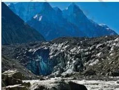
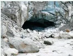
- The Ganga’s start: the river’s tributary the Bhagirathi begins at Gaumukh (‘Cow’s Mouth’), the edge of the Gangotri Glacier (p.4).
- Three ranges in height order: Himadri, Himachal, Shivalik (p.6). Use the memory aid H-H-S: Himadri (highest), Himachal (hill stations), Shivalik (smallest and outermost).
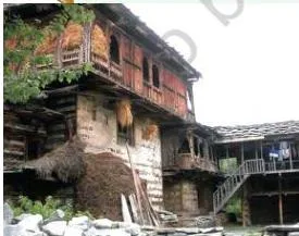
- Life and buildings: kath-kuni houses in the western Himalaya combine stone and wood, stay warm, and resist mild earthquakes (p.6).
- Protected area: the Great Himalayan National Park is a UNESCO World Heritage Site (p.7).
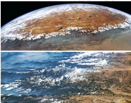
Reading Fig. 1.2: the view shows the range as a single curving arc. The map legend uses colour for altitude, so the snow-covered heights mark the Himadri and the lower foothills mark the Shivalik.
Ladakh — the cold desert, the ‘moonland’
A desert is defined by dryness, not heat. Ladakh is a cold desert with winter temperatures below -30°C and very little rainfall (NCERT, p. 8).
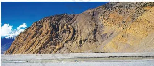
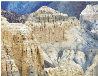
- ‘Moonland’: the rocks here were once an ocean floor. When India collided with Eurasia this rock folded, and wind and rain later carved it into moon-like shapes (p.8).
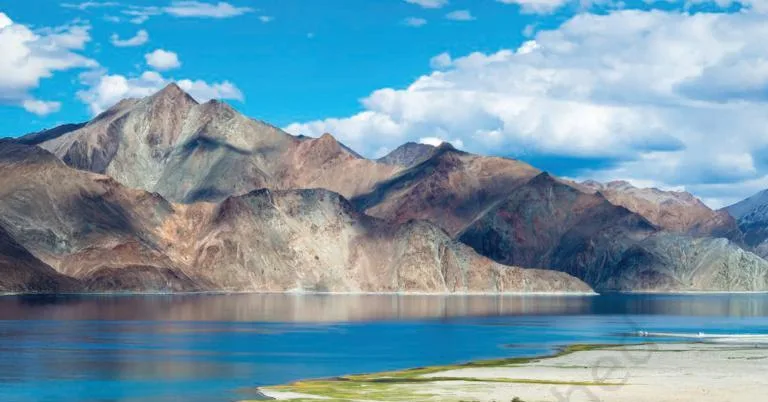
- Salty lake: Pangong Tso has salty water because minerals dissolve from the surrounding mountains into the lake (p.9).
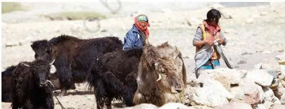
- Yaks matter: they give milk, meat, wool and dung, and carry loads for transport (p.8).
- Wildlife and culture: snow leopards, ibex and Tibetan antelopes live here; old monasteries and festivals like Losar and Hemis mark the region’s culture (p.8).
Fig. 1.8 shows the moonland appearance. The book explains that these rocks were part of an ocean floor, folded during the collision with Eurasia, then eroded by wind and rain.
Fig. 1.10 answers a common doubt: not all lakes are fresh. Pangong Tso’s salt comes from minerals that dissolve from the surrounding mountain areas (p.9).
The Gangetic Plains — rivers, farms and dense settlement
South of the Himalayas, the Ganga, Indus and Brahmaputra systems build one of the world’s most fertile plains. A large share of India’s population lives here (NCERT, p. 9).
- Rivers and tributaries bring minerals that enrich the soil for farming; the rivers also generate electricity (p.9).
- Flat land supports multi-cropping and paddy, and allows long road and railway networks (p.10).
- Wildlife includes the tiger, which Project Tiger helped bring back, the endangered gharial (2.5-4.5 m) and the peacock, India’s national bird (pp.11-12).
- The Brahmaputra means ‘son of Brahma’. It grows in summer instead of drying up — a riddle the book asks you to solve (p.11).
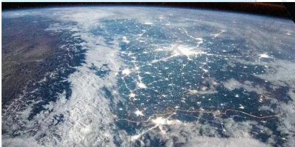
Fig. 1.16 is a night-time satellite view. The concentration of lights shows where people cluster — the book asks you to explain that concentration (p.11).
The Thar Desert and the Aravalli barrier
The west holds India’s hot desert, and an ancient range of hills stops it from advancing east. The Thar spans Rajasthan, Gujarat, Punjab and Haryana (NCERT, p. 13).
- Wind shapes sand into dunes that can rise 150 m (pp.12-13).
- The desert has high daytime heat, cold nights and scarce water (p.13).
- Jaisalmer, the ‘Golden City’, stands in the middle of the Thar; its fort is a UNESCO World Heritage Site (p.13). The Pushkar Mela is held at the desert’s edge (p.13).
- Everyday adaptation: women fetch water from far away, utensils are scoured with sand, and rinse water is reused (p.14).
- Rajasthan’s taanka and kunds store rainwater, often for drinking (p.14).
- The Aravallis, about 2.5 billion years old with Mount Abu above 1700 m, block the Thar from spreading east (p.15). Their rocks include marble, granite, zinc and copper; Zawar’s mines show Indians mastered zinc extraction over eight centuries ago (p.15). Forts like Chittorgarh, Kumbhalgarh and Ranthambore stand in these hills (p.15).
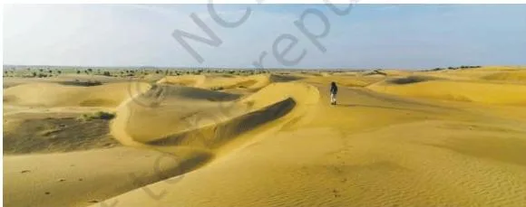
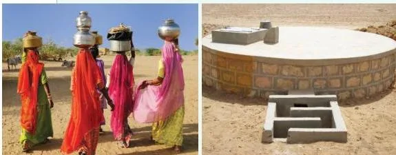
Fig. 1.24 shows what water scarcity really looks like. That is why desert households clean utensils with sand, reuse rinse water and collect rainwater in taankas and kunds (p.14).
| Aspect | Ladakh — cold desert | Thar — hot desert |
|---|---|---|
| Climate | winters below -30°C | very high daytime heat, cold nights |
| Rainfall | very little | water is scarce |
| Landscape | rocky terrain, deep valleys, ‘moonland’ | sand dunes up to 150 m |
| Daily adaptation | yaks provide milk, meat, wool, dung and transport | women fetch water, sand-cleaned utensils, taanka-kund storage |
| Reference | NCERT p. 8 | NCERT pp. 12-14 |
The peninsular plateau and the two Ghats
This section explains two terms in boxes. A plateau is a raised landform with a flat top and often steep sides. A peninsula is land surrounded by water on three sides (NCERT, p. 16).
- The southern triangular plateau is bordered by the Western Ghats (taller, wall-like; called Sahyadri in the north) and the Eastern Ghats (lower, broken into smaller hills). Between them lies the Deccan Plateau (p.16).
- East-flowing rivers — Godavari, Krishna, Kaveri and Mahanadi — drain into the Bay of Bengal. West-flowing rivers — Narmada and Tapti — drain into the Arabian Sea (pp.16-17).
- Rivers drop over uneven rocky surfaces to make waterfalls, which provide hydroelectric power and irrigation water (p.17).
- The Western Ghats are a UNESCO World Heritage Site with rich biodiversity — lion-tailed macaques, king cobras and even insectivorous plants (p.18).
- Coal mines on the plateau make electricity, but coal is a fossil fuel linked to global warming (p.18).
- Tribal communities — Santhal, Gond, Baiga, Bhil and Korku — live in the plateau’s forests, largely in states such as Jharkhand, Chhattisgarh and Odisha (p.17).
| Direction of flow | Rivers | Drains into |
|---|---|---|
| East-flowing | Godavari, Krishna, Kaveri, Mahanadi | Bay of Bengal (pp.16-17) |
| West-flowing | Narmada, Tapti | Arabian Sea (p.17) |
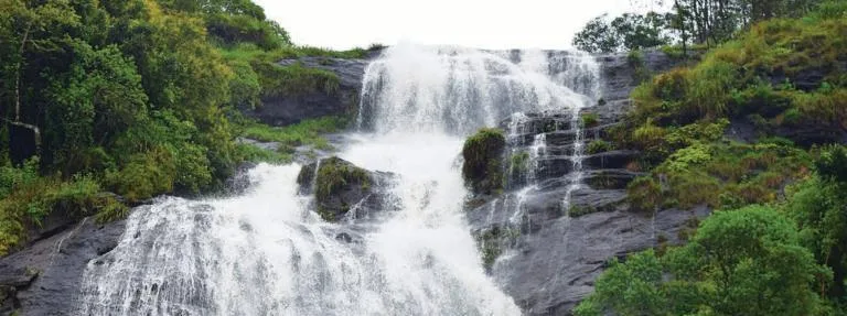
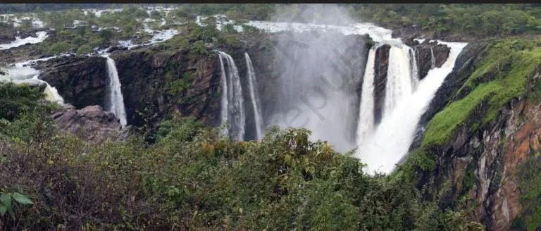
Fig. 1.28 shows the plateau story: rivers flowing over uneven rocky surfaces create waterfalls, and the falling water is used to generate hydroelectric power. Jog Falls on the chapter’s first page shows the same idea (p.1).
From the coasts to the islands, the Sundarbans and the Northeast hills
The chapter finishes its flight around India’s edge. The best way to revise this section is to contrast east with west.
- The Indian coastline is over 7500 km long (p.19).
- West coast (Gujarat to Kerala): rivers from the Western Ghats are short and swift; they form estuaries — broad funnel-shaped mouths. The Narmada and Tapti estuaries are the largest, and the coast has many important ports and cities (p.19).
- East coast (Ganga delta to Kanyakumari): wide plains and the big deltas of the Mahanadi, Godavari, Krishna and Kaveri. Lagoons such as Chilika and Pulicat lie here (p.20).
- Delta: a triangular or fan-shaped area formed when a river deposits sediments at its mouth (p.20).
- Islands: Lakshadweep is an archipelago of 36 coral islands in the Arabian Sea; the Andaman and Nicobar Islands are more than 500 volcanic islands in two groups, site of the Cellular Jail (pp.20-21).
- Barren Island in the Andaman and Nicobar group is India’s only active volcano (p.22).
- Sundarbans: the delta of the Ganga and Brahmaputra, about half in India, a UNESCO site and home of the Royal Bengal Tiger (p.22).
- Northeast hills: Garo, Khasi and Jaintia, part of the Meghalaya Plateau, see some of the world’s heaviest rainfall. Mawlynnong, in the East Khasi Hills, is known as the ‘cleanest village in Asia’; living root bridges are made by weaving tree roots over years (pp.23-24).
| Feature | West coast | East coast |
|---|---|---|
| Where rivers meet the sea | form estuaries — broad funnel-shaped mouths | form deltas — triangular or fan-shaped land |
| Main rivers | short swift rivers from the Western Ghats; Narmada and Tapti estuaries largest | Mahanadi, Godavari, Krishna and Kaveri deltas |
| Other features | ports and cities, coves and creeks | wide plains; lagoons such as Chilika and Pulicat |
| Reference | NCERT p. 19 | NCERT p. 20 |
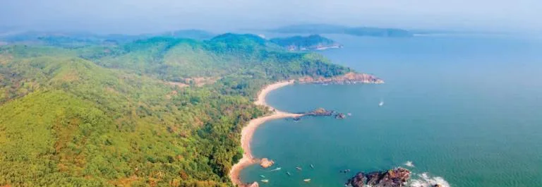
Fig. 1.34 explains why the west coast has estuaries: the hills sit so close to the sea that rivers stay short and swift, with little room to build deltas.
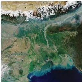
Fig. 1.35 shows the contrast: the east coast has a wide, flat band, so rivers spread out and drop sediments to form large deltas and lagoons.
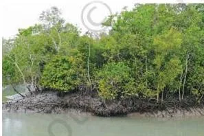
Fig. 1.40 shows the Sundarbans, a delta with a unique mix of river, sea and land. It is home to the Royal Bengal Tiger and is a UNESCO site (p.22).
Figure Walkthrough: How to Read the Chapter’s Images
This chapter keeps asking you to read satellite views and formation diagrams. The skill is the same each time: identify the landform, read what the colours show, and ask how it formed.
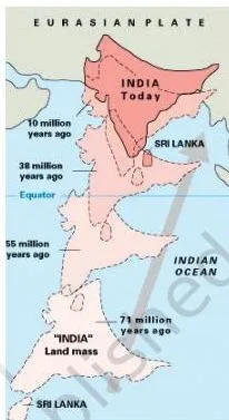
Fig. 1.4 — India’s journey to Eurasia
Read the diagram as a timeline. India was part of Gondwana, broke off, moved north, and met Eurasia about 50 million years ago. The land between crumpled and rose, like a cloth pushed across a table wrinkling at the front (p.5).
India still pushes north about 5 cm a year, and the Himalayas still rise about 5 mm a year (p.5). Work out how much the mountains have grown since you were born:
Step 1: The Himalayas rise about \(5\ \text{mm}\) a year.
Step 2: Multiply by your age.
For a 12-year-old, \(12 \times 5\ \text{mm} = 60\ \text{mm}\).
\[ 60\ \text{mm} = 6\ \text{cm} \]
Answer: the Himalayas have risen about 6 cm since that reader was born.
Fig. 1.5 — Folded layers of Himalayan rock
The folded layers are the visible proof of the crumpling shown in Fig. 1.4. The same folded rock, once an ocean floor, later became Ladakh’s ‘moonland’ after wind and rain carved it (pp.5, 8).
Fig. 1.25 — The Aravalli ridge from space
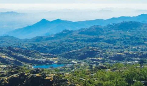
In the space view, the ridge line of the Aravallis runs like a wall. Just beyond it the Thar begins; this is the natural barrier that stops the desert from spreading east (pp.14-15).
Fig. 1.36 and Fig. 1.39 — Two ways islands form
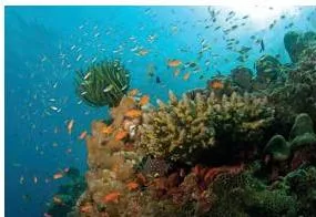
Coral reefs like Fig. 1.36 are built by living organisms in warm shallow seas. They form Lakshadweep’s 36 islands (p.21).
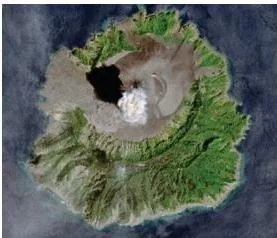
Barren Island in Fig. 1.39 is volcanic. It is the only active volcano in India and can send smoke and lava into the sky (p.22). Contrast the two: one grows from life, the other from heat inside the Earth.
Fig. 1.42 — Living root bridges
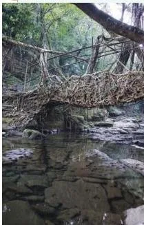
These bridges are made by weaving tree roots over many years, so they grow stronger as the trees grow. They show people shaping nature patiently, and they are part of life near Mawlynnong in Meghalaya (p.24).
Key Definitions in Plain Words
The chapter defines several terms in boxes. This table restates each one simply.
| Term | What it means | NCERT page |
|---|---|---|
| Subcontinent | A large landmass that is part of a continent but stands apart from it, like India within Asia | p.2 |
| Eight Thousanders | Mountain peaks that rise above 8000 m | p.4 |
| Plateau | A raised landform with a more or less flat top, often with steep sides | p.16 |
| Peninsula | A piece of land surrounded by water on three sides | p.16 |
| Delta | The triangular or fan-shaped land formed where a river deposits sediments into a larger water body | p.20 |
| Estuary | A broad, funnel-shaped mouth where a river meets the sea. The book describes west-coast rivers forming estuaries without boxing the term | p.19 |
| Lagoon | A body of water separated from the larger sea by a natural barrier | p.20 |
| Archipelago | A group of islands | p.21 |
Most of these terms describe why India’s geography looks the way it does — a peninsula with a plateau, plains with deltas, and island groups with different origins.
Common Mistakes Students Make With This Chapter
These six traps come straight from the chapter’s own content. Each one has a correction and a quick way to check yourself.
| Mistake | Correct rule | How to check your answer |
|---|---|---|
| ‘Deserts are always hot’ | Deserts are areas with very little rainfall. Ladakh is a cold desert with winters below -30°C (p.8) | Ask: is the desert defined by rain or by temperature? |
| ‘All lakes are freshwater’ | Pangong Tso is salty because minerals dissolve from the surrounding rocks into the lake (p.9) | Ask where the lake’s water comes from and what it passes through |
| ‘The three Himalayan ranges are the same’ | From highest to lowest: Himadri, Himachal, Shivalik (p.6) | Order them from snow line down to the plains |
| ‘All Indian rivers flow east’ | Godavari, Krishna, Kaveri and Mahanadi flow east, but Narmada and Tapti flow west into the Arabian Sea (p.17) | Trace each river on the physical map to its mouth |
| ‘The two coasts look alike’ | The west coast has short rivers and estuaries; the east coast has wide plains, big deltas and lagoons (pp.19-20) | Look for delta triangles on the east and funnel-shaped estuaries on the west |
| ‘The two island groups are the same’ | Lakshadweep is made of coral; the Andaman and Nicobar Islands are volcanic, with Barren Island still active (pp.20-22) | Ask how each island formed |
How This Chapter Is Usually Asked
The chapter never gives you a separate worksheet. It asks through Big Questions, LET’S EXPLORE prompts and the closing exercise set.
The two Big Questions are the spine
- What are some key geographical features of India?
- How does India’s geographical diversity affect our lives?
If you can answer both in your own words, you hold the chapter (p.1).
The LET’S EXPLORE prompts are map skills in disguise
- Reading the map legend and what colours mean (p.2)
- Locating states across the Himalayas (p.6)
- Tracing the route from the Thar towards the Aravallis (pp.12-15)
- Noticing the direction of river flow (p.16)
- Locating the Sundarbans delta (p.22)
The book’s own advice is to keep the physical and political maps open while studying (p.2).
Where each closing question finds its answer
| Closing question | Where the chapter builds the answer |
|---|---|
| ‘Two important geographical features of India’ | Whole chapter; start with the five regions on pp.2-3 |
| ‘India without the Himalayas’ | Formation and role of the Himalayas, pp.3-6 |
| ‘Mini-continent’ | p.2 plus the landform tour across pp.3-24 |
| ‘Follow one of India’s big rivers’ | Plains rivers on pp.9-11; plateau rivers on pp.16-17 |
| ‘Peninsular plateau’ | Definitions and the two Ghats on p.16 |
| ‘Which UNESCO Heritage Site?’ | Four sites listed below |
| ‘Identify the place you are at now’ | Physical and political maps at the end of the book, p.24 |
| ‘Food preservation techniques’ | Local adaptation in the Thar, pp.13-14 |
| ‘How geography has united people’ | Closing recap on p.24 |
A useful synthesis: the chapter mentions four UNESCO World Heritage sites — the Great Himalayan National Park (p.7), the Jaisalmer Fort (p.13), the Western Ghats (p.16) and the Sundarbans (p.22).
Revision Summary: The Chapter in Ten Lines
The book’s own ‘Before we move on…’ block on p.24 gives the big idea: diverse geography shaped India’s soil, life and culture. Here is the whole chapter in ten lines:
- India gives its name to the subcontinent it is part of.
- The Himalayas are a 2500 km wall, the ‘Water Tower of Asia’ (p.3).
- Ladakh is a cold desert and a ‘moonland’ with the salty Pangong Tso (p.8).
- The Gangetic Plains are fertile, flat, river-watered and densely settled (p.9).
- The Thar is a hot desert where people save every drop of water (p.12).
- The ancient Aravallis stop the Thar from spreading east (p.15).
- The peninsular plateau sits between the Western and Eastern Ghats (p.16).
- The west coast has estuaries; the east coast has deltas and lagoons (pp.19-20).
- Lakshadweep is coral; the Andaman and Nicobar Islands are volcanic (pp.20-21).
- The Sundarbans delta and the rain-soaked Northeast hills complete the journey (pp.22-23).
Related Resources
This listing is maintained for the 2026-27 academic session using the NCERT textbook information available to us. NCERT remains the authority for confirming the latest edition.
Need the full book? Start from the Class 7 Social Science book page. For quick revision support, use the Class 7 Social Science notes index or the main Class 7 hub. From the main CBSE notes home you can reach every class. If this chapter is leading you towards weather and climate, the Understanding the Weather notes are a useful follow-up.
The official chapter PDF link above remains the fastest way to the original text.
| What the chapter holds | Count | Where it is used |
|---|---|---|
| Printed pages | 26 | |
| Figures with NCERT captions | 47 | |
| Official NCERT PDF | Download the chapter PDF | the chapter exactly as NCERT publishes it |
Reference: NCERT Class 7 Social Science textbook, chapter 1, official edition on ncert.nic.in.
Sources and Data Verification
- The page describes the NCERT Class VII Social Science textbook Exploring Society: India and Beyond (Part 1), Chapter 1 ‘Geographical Diversity of India’, official edition on ncert.nic.in.
- It covers this single chapter only — not other chapters of the book, and not other Class 7 books.
- It is maintained for the current academic session using the NCERT information available to us.
- NCERT settles textbooks, editions and PDFs; CBSE settles curriculum, syllabus and examinations. Textbook contents and the examinable syllabus are not always identical, so check the current official syllabus.
Frequently Asked Questions
Why is Ladakh called a cold desert?
Because deserts are defined by how little rain they get, not by heat. Ladakh has very little rainfall and winter temperatures below -30°C, so it is a desert that happens to be cold (NCERT, p. 8).
What are the five regions of India named in this chapter?
The book names five regions for discussion: the great mountain zone, the plains of the Ganga and the Indus, the desert region, the southern peninsula, and the islands (NCERT, p. 2).
Why is India called a mini-continent?
Because one country contains snowy mountains, river plains, a hot desert, a peninsular plateau, two very different coasts and island groups — almost every major landform and climate type (NCERT, p. 2, with the tour on pp.3-24).
What is the difference between the west coast and the east coast of India?
The west coast has short swift rivers that form estuaries, with the Narmada and Tapti estuaries the largest. The east coast has wide plains, the big deltas of the Mahanadi, Godavari, Krishna and Kaveri, and lagoons such as Chilika and Pulicat (NCERT, pp.19-20).
Which is the only active volcano in India?
Barren Island, in the Andaman and Nicobar Islands, is the only active volcano in India. It sometimes erupts, sending smoke and lava into the sky (NCERT, p. 22).
Why does the Brahmaputra grow bigger in summer instead of drying up?
The chapter poses this as a ‘Can you guess why?’ riddle rather than answering it directly (p.11). The answer built from the book is that summer snowmelt in the Himalayas feeds the river (p.4), and the monsoon rains add huge amounts of water as well. So the river swells in summer instead of shrinking.
Explore Class 7 Social Science Books
- Next: Understanding the Weather
Related chapters:
- Climates of India
- New Beginnings:
- The Rise of Empires